Old Town Print Gallery
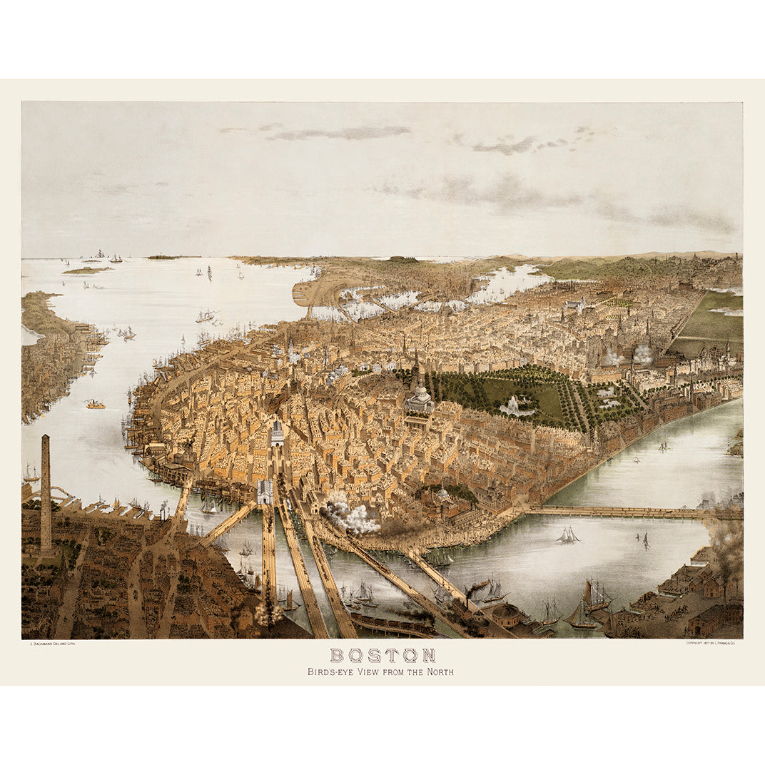
Bird's-Eye View of Boston from the North
Pickup available at Old Town Print Gallery
Usually ready in 2-4 days
Created in 1877, this pictorial map of Boston is the second of its kind of the city that John Bachman made during the mid-late 1800s. This view shows Boston from the north, from a birds-eye view perspective. These pictorial maps allowed makers to place emphasis on prominent landmarks and new developments, rather than focusing on a strict depiction of the city.
In this case, Bachman highlights the State House, Common, and Public Garden, placing them in the center of the map. The trains running in and out of the city, billowing smoke, display the significance of rail travel to the growth of Boston. Additionally, docks and ships offer insight into maritime trade that also helped fuel economic growth. These pictorial maps give us a unique look into the history of a city; not only do we see how it used to look, but we also see what was most important at that time.
Well over a century old, this map had accumulated its fair share of wear and tear. Old maps and documents will fade and discolor over time, and can also be quite fragile, with many showing signs of damage. Thanks to our digital restoration team, this Boston map has been restored to its original, pristine condition. We're thrilled to offer reproduction prints of this unique piece on both paper and canvas.
Our reproduction prints are available in a range of sizes, but if you don't see what you need, please reach out! We're happy to accomodate custom requests whenever possible.

