Old Town Print Gallery
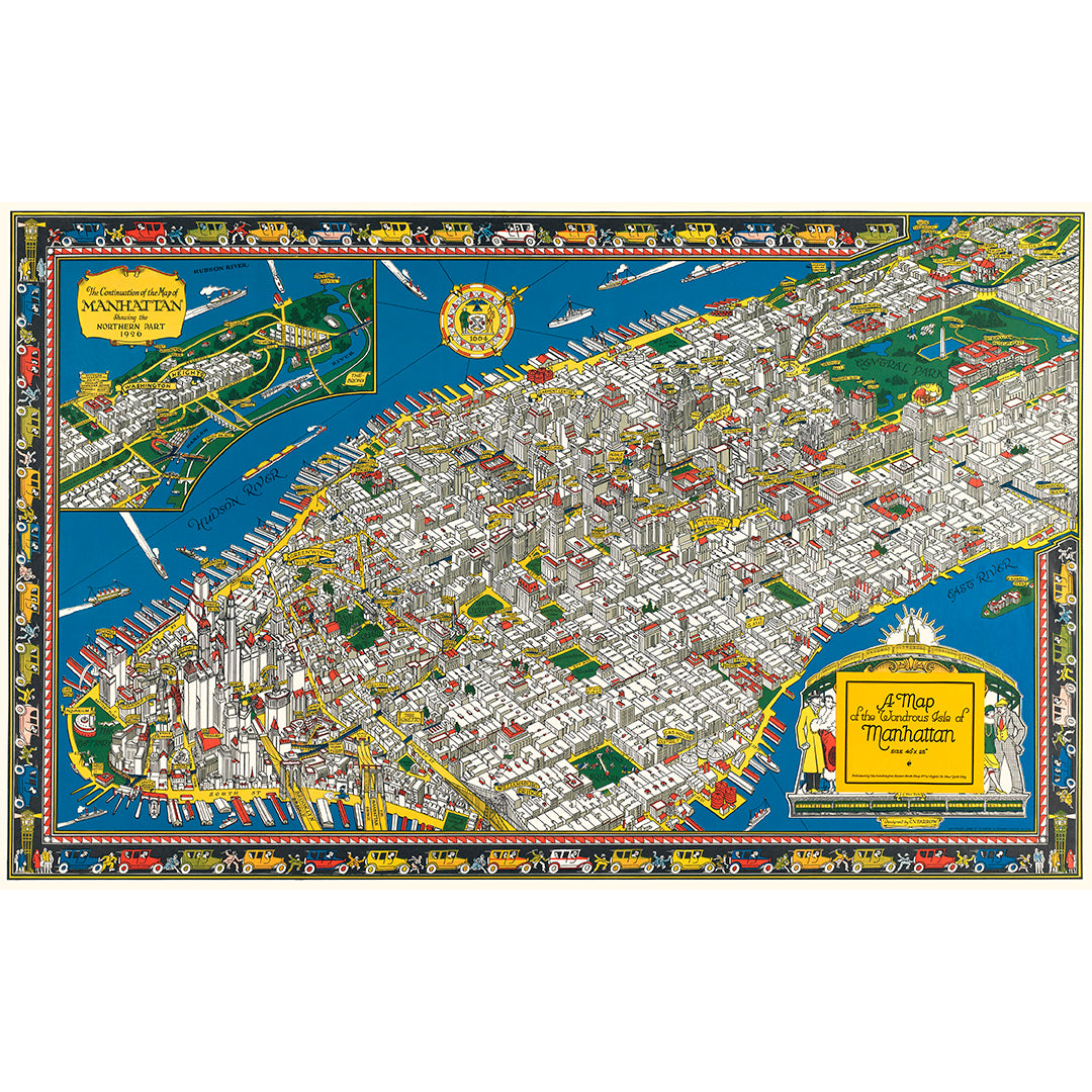
Map of "The Wondrous Isle" of Manhattan
Pickup available at Old Town Print Gallery
Usually ready in 2-4 days
Featuring the title "A Map of the Wondrous Isle of Manhattan", this unique vintage map is a beautiful example of pictorial mapmaking. Pictorial maps focus more on artistic style rather than technical precision. Streets and buildings are rarely drawn to the exact scale in order to emphasize certain aspects over others.
This particular pictorial map was drawn by C. Vernon Farrow in 1926 and features Manhattan north to 110th street. The map features brand-new skyscrapers and includes banner-style labels for many notable buildings. Many parks are also named on the map. At the top left of the map, there is a separate section titled "The Continuation of the Map of Manhattan Showing the Northern Part 1926", which features Washington Heights. The colorful border that surrounds the map features speeding cars and hurried pedestrians, alluding to the general hustle and bustle of the city.
Nearly a century old, this map had started to feel the effects of time, namely fading, discoloration, and general wear and tear. Our skilled team has digitally restored this beautiful map to its original condition, ridding it of the ravages of time. Once again pristine, we're pleased to offer reproduction prints on fine art paper and canvas.
Our prints are made in our studio in Alexandria, Virginia. Each and every print is carefully inspected, ensuring only the highest-quality prints leave our studio. We use museum-quality, archival materials, so you can be sure that your print from Old Town Print Gallery will last you a lifetime.
We understand each customer's needs are unique, like our prints. Need a custom size? Have any special requests? We are all ears!

