

Old Town Print Gallery
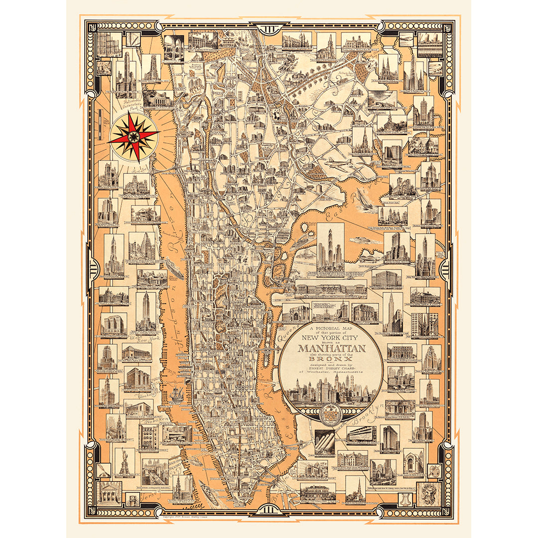
Pictorial Map of Manhattan & The Bronx
Pickup available at Old Town Print Gallery
Usually ready in 2-4 days
Ernest Dudley Chase created this vintage map in 1939. The map is a pictorial representation of Manhattan and parts of the Bronx. Noteworthy buildings are illustrated on the map itself, and there are additional larger illustrations surrounding the main map, labeled with identifications of the locations.
We've digitally restored this map, taking care to keep it historically accurate while repairing damage and correcting fading and discoloration. With the digital restoration complete, we now offer reproduction prints of this vintage map. Paper prints and stretched canvases are available in a range of sizes. You can reach out to us anytime if you'd like to discuss a custom size/print, and you can find additional information about our prints and materials here!
Vintage posters were not made in standard sizes, so unfortunately, we aren't able to offer all of our posters in the exact same sizes. In an effort to create a standard system, the sizing for our posters is based on the long dimension of each image. While the short dimensions will vary, you can order multiple prints with the same long dimension to create a uniform look when displaying your prints.